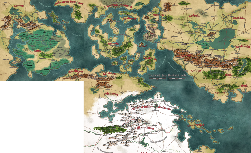
While I’m creating Godsbarrow region by region, in “tiles” which are more or less square, I’ve also been stitching those tiles together into a larger map. As you can see on that map, it’s full of small and medium problems as a result of this rough-and-ready approach: almost nothing along the tile boundaries lines up perfectly, country names appear several times, roads begin or end at random because I forgot I had a road there on the neighboring regional map, etc.

And that’s fine! My main goal has been to safeguard my creative energy and preserve my forward momentum, and given that today is just 10 days shy of a year of daily work on Godsbarrow, that approach has been successful.
But I’ve always known there would need to be a cartographic reckoning, and I’ve kind of dreaded how much work it might involve. It hit me this morning that there would be more work if I continued working on the Middenglum map as its own entity, rather than slotting it into the multi-region poster map and finishing it there.
So I did a bit of poking around, found a Reddit post about copying and pasting landmasses, and gave that a shot. Wonderdraft’s polygonal lasso tool allows you to copy a landform on one map file and paste it into another map file, and it preserves any colors you’ve applied to the source landmass.
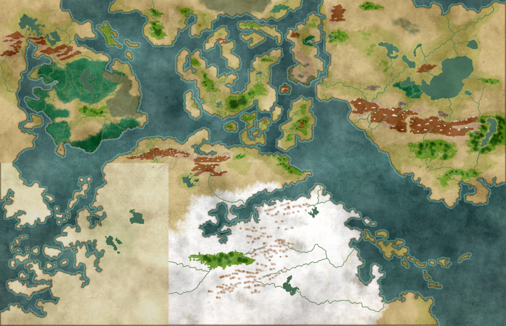
About 15-20 minutes later, I had this:

There’s still lots of work to do, but this approach saved me at least a few hours of painstakingly tracing coastlines. It also affords me a fourfold opportunity, one element of which came as a surprise:
- Fix all the issues created by making these maps individually
- Settle on a scale
- Decide if I still like my mapmaking style
- Tweak the landmasses
#1 is covered in this post. #2 is sort of an offshoot of #1, but involves less work. I initially chose a scale that seemed too small, then too large, and then stopped thinking about it and just kept making maps. For a finished poster map, I need a scale. In terms of my mapmaking style, #3, I still like it. I’m obviously not a professional cartographer, but if I bought a book with one of my maps in it I wouldn’t be sad.
Item #4 is what surprised me. Seeing the landmasses with no symbols or labels makes it so clear that I created this map as four squares and a rectangle, and highlights how I got better about making it look more natural and organic later on. The earlier top half, especially my first region, the Unlucky Isles, looks more “squared off” than the bottom half.
There’s nothing sacred about my maps at this stage. Godsbarrow is a world still in development, and I’ve certainly come up with stuff in the past couple months that needs to be taken into account in the write-ups for earlier regions.
Take the Red Flag pirates of Middenglum, for example. Warriors from Kuruni, always looking for a way to prove themselves, would absolutely be raiding the pirate isles of Go Quietly Strait. And the Brundiri navy, despite having its hands full in the Unlucky Isles, needs to patrol the southern Alpan Sea to keep those same pirates at bay. But when I created Brundir and Kuruni, Middenglum and the Red Flag pirates didn’t exist.
That’s Future Martin’s problem, and it’s one I’ve known about from day one. I love the raw fire of creation, just Naruto-running through region after region and keeping that fire stoked — and I know that if I’d started with a blank version of this six-tile poster map, 1) I probably wouldn’t have gotten very far, and 2) even if I did maintain my momentum, it would have felt boring and same-y compared to the weird, vibrant stew of ideas that has emerged by doing it one region at a time.
For the second poster map, once Middenglum is done and I’ve polished the current poster map, I probably will start with a larger blank canvas and fill it in one region at a time. I have a year of experience following the Worlds Without Number approach, and a year of work upon which to build, and I think I can thread the needle of staying loose and creative while also avoiding the need to redo another giant map in 2023.
Updated later in the day to add: Even with the landmasses, water, and colors in place, redrawing all the symbols and paths is slow going. I’ve spent about four hours on this today, and I’ve got all the settlements and roads and about a third of the mountains/hills done.
I believe it’s possible to copy all the symbols on one map and paste them onto another, but only as a sort of “flattened” single image which cannot be edited. While redrawing everything is certainly slower, it also gives me the opportunity to tweak as I go (e.g., I said southern Ahlsheyan was more settled, but didn’t actually have that many towns; let’s add a few).
(This post is one of a series about worldbuilding with Worlds Without Number. I’m using the setting-creation approach detailed in Worlds Without Number [paid link], which is a fantastic resource.)
